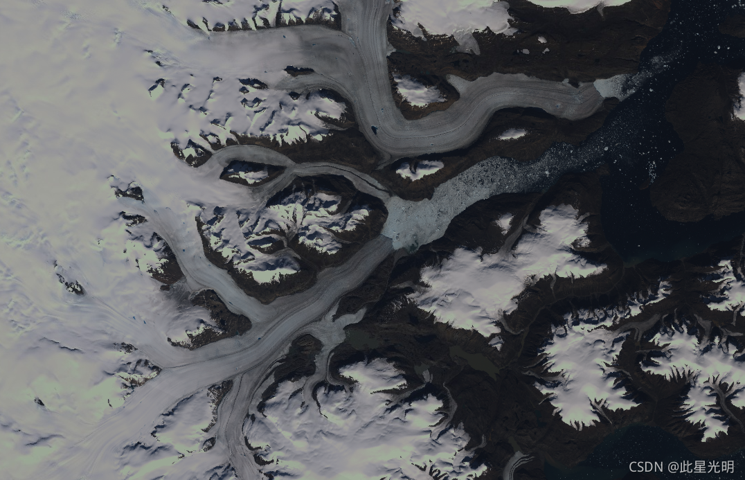
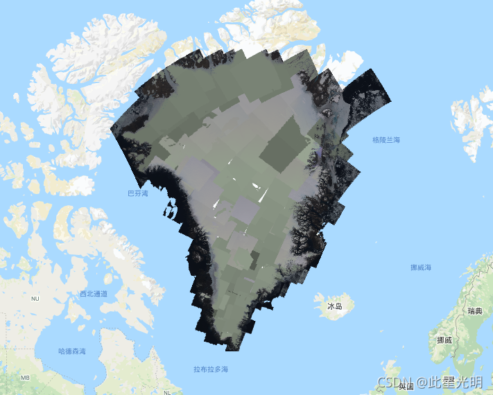
This dataset provides a complete 15 m resolution image mosaic of the Greenland ice sheet derived from Landsat 7 ETM+ and RADARSAT-1 SAR imagery from the years 1999 to 2002. The methods include a combination of image cloud masking, pan sharpening, image sampling and resizing, and image coregistration. Please see Howat, 2014 for more information regarding processing methods.
Note
- Users of GIMP DEM or GIMP 2000 Image Mosaic images may find it helpful to mask out areas outside of the Greenland coastline using the corresponding 15 m ocean mask image Greenland Ice Mapping Project (GIMP) Land Ice and Ocean Classification Mask,
- The SAR data are distributed at 20 m resolution. Data were up-sampled through bilinear interpolation to 15 m to match the resolution of Landsat band-8.
该数据集提供了格陵兰岛冰盖的完整的15米分辨率的图像马赛克,该图像来自1999年至2002年的Landsat 7 ETM+和RADARSAT-1 SAR图像。这些方法包括图像云遮蔽、平移锐化、图像取样和大小调整以及图像核对的组合。关于处理方法的更多信息,请参见Howat, 2014。
备注
GIMP DEM或GIMP 2000图像马赛克的用户可能会发现,使用相应的15米海洋掩码图像格陵兰冰图项目(GIMP)陆地冰和海洋分类掩码来掩码格陵兰海岸线以外的区域是有帮助的。
SAR数据以20米的分辨率分布。数据通过双线性插值被上采样到15米,以匹配Landsat band-8的分辨率。
一般文件
Dataset Availability
1999-06-30T00:00:00 - 2002-09-04T00:00:00
Dataset Provider
Collection Snippet
ee.Image("OSU/GIMP/2000_IMAGERY_MOSAIC")
Bands Table
| Name | Description | Resolution | Wavelength |
| B1 | Landsat 7 ETM+ blue | 15 meters | 0.45 - 0.52 µm |
| B2 | Landsat 7 ETM+ green | 15 meters | 0.52 - 0.60 µm |
| B3 | Landsat 7 ETM+ red | 15 meters | 0.63 - 0.69 µm |
| B4 | Landsat 7 ETM+ near infrared | 15 meters | 0.77 - 0.90 µm |
| B5 | Landsat 7 ETM+ shortwave infrared 1 | 30 meters | 1.55 - 1.75 µm |
| B6_low_gain | Landsat 7 ETM+ low-gain thermal Infrared 1. This band has expanded dynamic range and lower radiometric resolution (sensitivity), with less saturation at high Digital Number (DN) values. Resampled from 60m to 30m. | 30 meters | 10.40 - 12.50 µm |
| B6_high_gain | Landsat 7 ETM+ high-gain thermal Infrared 1. This band has higher radiometric resolution (sensitivity), although it has a more restricted dynamic range. Resampled from 60m to 30m. | 30 meters | 10.40 - 12.50 µm |
| B7 | Landsat 7 ETM+ shortwave infrared 2 | 30 meters | 2.08 - 2.35 µm |
| B8 | Landsat 7 ETM+ panchromatic | 15 meters | 0.52 - 0.90 µm |
| B8_radarsat | RADARSAT-1 synthetic aperture radar amplitude imagery | 15 meters |
数据引用:
Howat, I.M., A. Negrete, B.E. Smith, 2014, The Greenland Ice Mapping Project (GIMP) land classification and surface elevation datasets, The Cryosphere, 8, 1509-1518, doi:10.5194/tc-8-1509-2014article pdf
代码:
var dataset = ee.Image('OSU/GIMP/2000_IMAGERY_MOSAIC');
var greenlandImage = dataset.select(['B3', 'B2', 'B1']);
var visParams = {
  min: 0.0,
  max: 255.0,
};
Map.setCenter(-29.1605, 70.4, 9);
Map.addLayer(greenlandImage, visParams, 'Greenland Pansharpened Image');