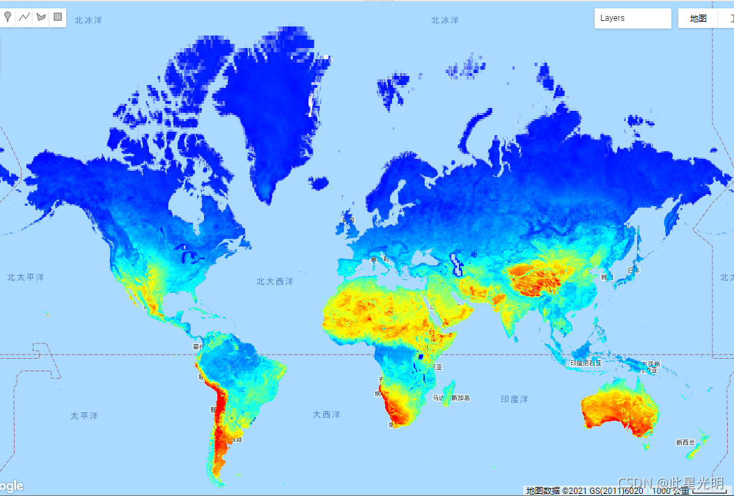
Long-term MODIS LST day-time and night-time differences at 1 km based on the 2000-2017 time series
Derived using the data.table package and quantile function in R . For more info about the MODIS LST product see this page. Antartica is not included.
To access and visualize maps outside of Earth Engine, use this page.
If you discover a bug, artifact or inconsistency in the LandGIS maps or if you have a question please use the following channels:
基于2000-2017年时间序列的长期MODIS LST昼夜差1公里
使用R中的data.table包和quantile函数得出。关于MODIS LST产品的更多信息,请参见本页面。不包括南极洲。
要访问和可视化地球引擎以外的地图,请使用这个页面。
如果您在LandGIS地图中发现了错误、伪装或不一致的地方,或者您有问题,请使用以下渠道。
关于代码的技术问题和疑问
一般问题和评论
Dataset Availability
2000-01-01T00:00:00 - 2018-01-01T00:00:00
Dataset Provider
Collection Snippet
ee.Image("OpenLandMap/CLM/CLM_LST_MOD11A2-DAYNIGHT_M/v01")
Resolution
1000 meters
Bands Table
| Name | Description | Min* | Max* | Units | Scale |
| jan | Long-term Land Surface Temperature monthly day-night difference | -40.5137 | 1336.09 | K | 0.02 |
| feb | Long-term Land Surface Temperature monthly day-night difference | -40.5137 | 1336.09 | K | 0.02 |
| mar | Long-term Land Surface Temperature monthly day-night difference | -40.5137 | 1336.09 | K | 0.02 |
| apr | Long-term Land Surface Temperature monthly day-night difference | -40.5137 | 1336.09 | K | 0.02 |
| may | Long-term Land Surface Temperature monthly day-night difference | -40.5137 | 1336.09 | K | 0.02 |
| jun | Long-term Land Surface Temperature monthly day-night difference | -40.5137 | 1336.09 | K | 0.02 |
| jul | Long-term Land Surface Temperature monthly day-night difference | -40.5137 | 1336.09 |
K | 0.02 |
| aug | Long-term Land Surface Temperature monthly day-night difference | -40.5137 | 1336.09 | K | 0.02 |
| sep | Long-term Land Surface Temperature monthly day-night difference | -40.5137 | 1336.09 | K | 0.02 |
| oct | Long-term Land Surface Temperature monthly day-night difference | -40.5137 | 1336.09 | K | 0.02 |
| nov | Long-term Land Surface Temperature monthly day-night difference | -40.5137 | 1336.09 | K | 0.02 |
| dec | Long-term Land Surface Temperature monthly day-night difference | -40.5137 | 1336.09 | K | 0.02 |
* = Values are estimated
引用:
Long-term MODIS LST day-time and night-time temperatures, sd and differences at 1 km based on the 2000-2017 time series 10.5281/zenodo.1420116
代码:
var dataset = ee.Image("OpenLandMap/CLM/CLM_LST_MOD11A2-DAYNIGHT_M/v01");
var visualization = {
  bands: ['jan'],
  min: -40.5137,
  max: 1336.09,
  palette: ['0000ff', '00ffff', 'ffff00', 'ff0000']
};
Map.centerObject(dataset);
Map.addLayer(dataset, visualization, "Long-term Land Surface Temperature monthly day-night difference");