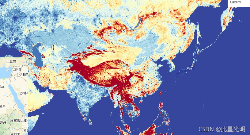
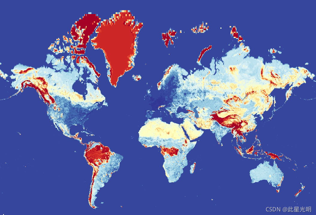
This global friction surface enumerates land-based travel speed for all land pixels between 85 degrees north and 60 degrees south for a nominal year 2015. This map was produced through a collaboration between the University of Oxford Malaria Atlas Project (MAP), Google, the European Union Joint Research Centre (JRC), and the University of Twente, Netherlands. The underlying datasets used to produce the map include roads (comprising the first ever global-scale use of Open Street Map and Google roads datasets), railways, rivers, lakes, oceans, topographic conditions (slope and elevation), landcover types, and national borders. These datasets were each allocated a speed or speeds of travel in terms of time to cross each pixel of that type. The datasets were then combined to produce this “friction surface”, a map where every pixel is allocated a nominal overall speed of travel based on the types occurring within that pixel, with the fastest travel mode intersecting the pixel being used to determine the speed of travel in that pixel (with some exceptions such as national boundaries, which have the effect of imposing a travel time penalty). This map represents the travel speed from this allocation process, expressed in units of minutes required to travel one meter. It forms the underlying dataset behind the global accessibility map described in the referenced paper.
Source dataset credits are as described in the accompanying paper.
这个全球摩擦面列举了北纬85度和南纬60度之间的所有陆地像素在2015年的名义年的陆地旅行速度。该地图是由牛津大学疟疾地图集项目(MAP)、谷歌、欧盟联合研究中心(JRC)和荷兰特文特大学合作制作的。用于制作该地图的基础数据集包括道路(包括首次在全球范围内使用开放街道地图和谷歌道路数据集)、铁路、河流、湖泊、海洋、地形条件(坡度和海拔)、土地覆盖类型以及国家边界。这些数据集都被分配了一个或多个旅行速度,即穿越该类型的每个像素的时间。然后,这些数据集被合并以产生 "摩擦面",在这张地图上,每个像素都被分配了一个基于该像素内发生的类型的名义总旅行速度,与该像素相交的最快旅行模式被用来确定该像素的旅行速度(有一些例外,如国家边界,它具有施加旅行时间处罚的效果)。这张地图代表了这个分配过程中的旅行速度,以旅行一米所需的分钟为单位表示。它构成了参考文件中描述的全球可及性地图的基础数据集。
源数据集的功劳在所附论文中描述。
Dataset Availability
2015-01-01T00:00:00 - 2016-01-01T00:00:00
Dataset Provider
Collection Snippet
ee.Image("Oxford/MAP/friction_surface_2015_v1_0")
Bands Table
| Name | Description | Min | Max | Resolution | Units |
| friction | Land-based travel speed. | 0.0005 | 87.307472 | 927.67 meters | minutes/meter |
引用:
D.J. Weiss, A. Nelson, H.S. Gibson, W. Temperley, S. Peedell, A. Lieber, M. Hancher, E. Poyart, S. Belchior, N. Fullman, B. Mappin, U. Dalrymple, J. Rozier, T.C.D. Lucas, R.E. Howes, L.S. Tusting, S.Y. Kang, E. Cameron, D. Bisanzio, K.E. Battle, S. Bhatt, and P.W. Gething. A global map of travel time to cities to assess inequalities in accessibility in 2015. Nature (2018). doi:10.1038/nature25181
代码:
var dataset = ee.Image('Oxford/MAP/friction_surface_2015_v1_0');
var landBasedTravelSpeed = dataset.select('friction');
var visParams = {
  min: 0.0022,
  max: 0.04,
  palette: [
    '313695', '4575b4', '74add1', 'abd9e9', 'e0f3f8', 'ffffbf', 'fee090',
    'fdae61', 'f46d43', 'd73027', 'a50026'
  ],
};
Map.setCenter(43.55, 36.98, 4);
Map.addLayer(landBasedTravelSpeed, visParams, 'Land-based travel speed');