Google Earth Engine ——MYD17A2H/A3H/GF V6总初级生产力(GPP)产品是一个具有500米分辨率的8天/16天累积综合数据。

简介: Google Earth Engine ——MYD17A2H/A3H/GF V6总初级生产力(GPP)产品是一个具有500米分辨率的8天/16天累积综合数据。

The MYD17A2H V6 Gross Primary Productivity (GPP) product is a cumulative 8-day composite with a 500m resolution. The product is based on the radiation-use efficiency concept and can be potentially used as inputs to data models to calculate terrestrial energy, carbon, water cycle processes, and biogeochemistry of vegetation.

Documentation:


MYD17A2H V6总初级生产力(GPP)产品是一个具有500米分辨率的8天累积综合数据。该产品基于辐射利用效率的概念,可作为数据模型的输入,计算陆地能源、碳、水循环过程和植被的生物地球化学。

Dataset Availability

2002-07-04T00:00:00 - 2021-09-14T00:00:00

Dataset Provider

NASA LP DAAC at the USGS EROS Center

Collection Snippet

ee.ImageCollection("MODIS/006/MYD17A2H")

Resolution

500 meters

Bands Table

Name Description Min Max Units Scale
Gpp Gross primary production 0 3000 kg*C/m^2 0.0001
PsnNet Net photosynthesis; GPP minus the maintenance respiration (MR) -3000 3000 kg*C/m^2 0.0001
Psn_QC Quality control bits 0
Psn_QC Bitmask
  • Bit 0: MODLAND QC bits
    • 0: Good quality
    • 1: Other quality
  • Bit 1: Sensor
    • 0: Terra
    • 1: Aqua
  • Bit 2: Dead detector
    • 0: Detectors apparently fine for up to 50% of channels 1, 2
    • 1: Dead detectors caused >50% adjacent detector retrieval
  • Bits 3-4: Cloud state
    • 0: Significant clouds NOT present (clear)
    • 1: Significant clouds WERE present
    • 2: Mixed cloud present on pixel
    • 3: Cloud state not defined, assumed clear
  • Bits 5-7: 5-level confidence quality score
    • 0: Very best possible
    • 1: Good, very usable, but not the best
    • 2: Substandard due to geometry problems - use with caution
    • 3: Substandard due to other than geometry problems - use with caution
    • 4: Couldn't retrieve pixel (NOT PRODUCED AT ALL - non-terrestrial biome)
    • 7: Fill Value

使用说明:

MODIS data and products acquired through the LP DAAC have no restrictions on subsequent use, sale, or redistribution.

引用:LP DAAC - MYD17A2H

代码:

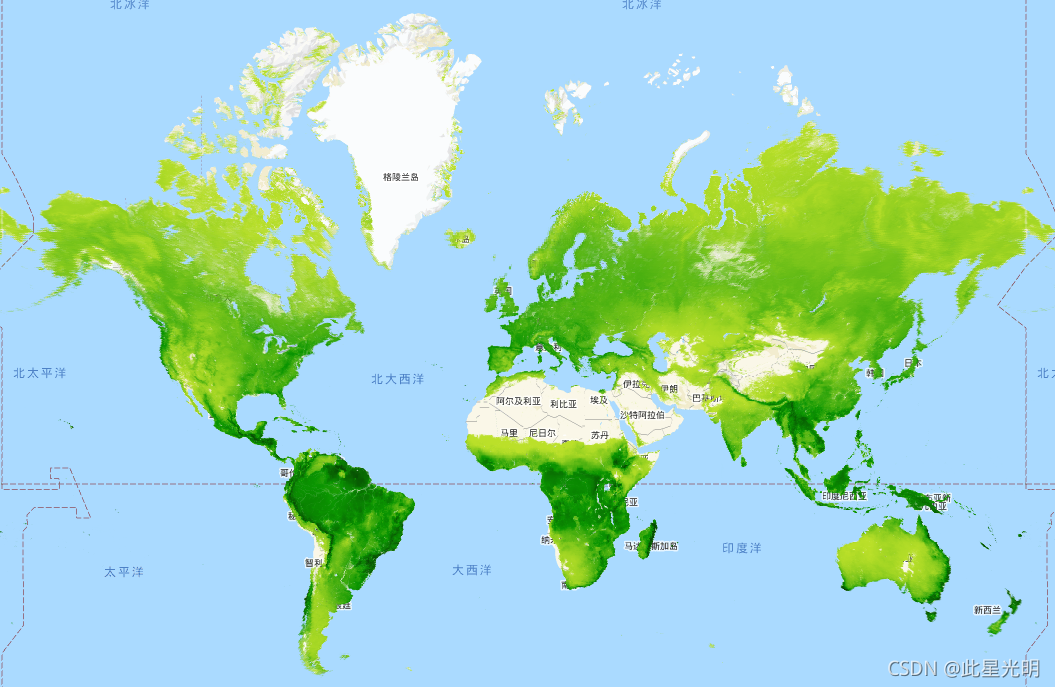
var dataset = ee.ImageCollection('MODIS/006/MYD17A2H')
                  .filter(ee.Filter.date('2018-01-01', '2018-05-01'));
var gpp = dataset.select('Gpp');
var gppVis = {
  min: 0.0,
  max: 600.0,
  palette: ['bbe029', '0a9501', '074b03'],
};
Map.setCenter(6.746, 46.529, 2);
Map.addLayer(gpp, gppVis, 'GPP');

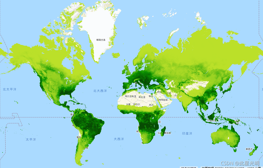
var dataset = ee.ImageCollection('MODIS/006/MYD17A3H')
                  .filter(ee.Filter.date('2014-01-01', '2014-05-01'));
var npp = dataset.select('Npp');
var nppVis = {
  min: 0.0,
  max: 19000.0,
  palette: ['bbe029', '0a9501', '074b03'],
};
Map.setCenter(6.746, 46.529, 2);
Map.addLayer(npp, nppVis, 'NPP');

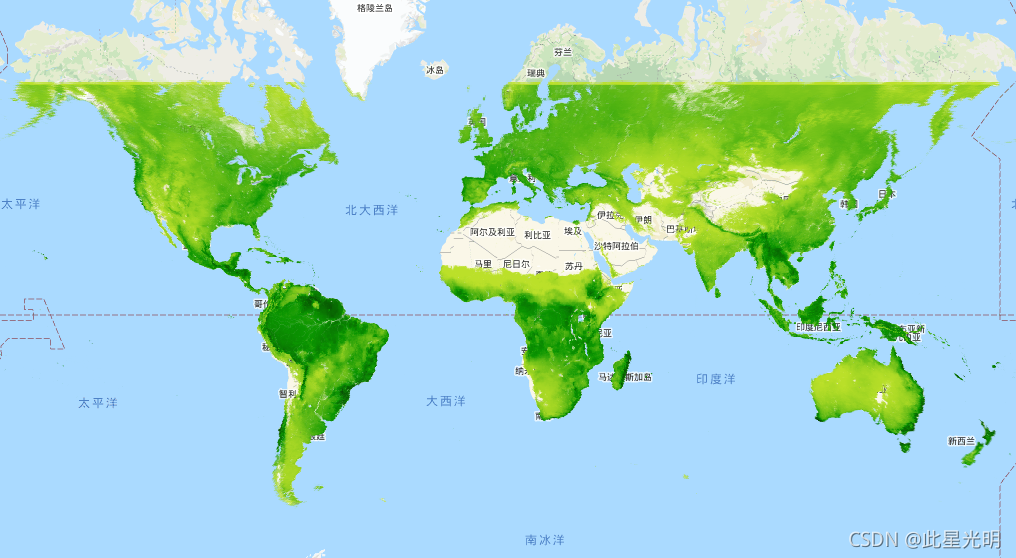
var dataset = ee.ImageCollection('MODIS/006/MYD17A3HGF')
                  .filter(ee.Filter.date('2014-01-01', '2014-05-01'));
var npp = dataset.select('Npp');
var nppVis = {
  min: 0.0,
  max: 19000.0,
  palette: ['bbe029', '0a9501', '074b03'],
};
Map.setCenter(6.746, 46.529, 2);
Map.addLayer(npp, nppVis, 'NPP');


相关文章
|
3月前
|
数据可视化 定位技术 Sentinel
如何用Google Earth Engine快速、大量下载遥感影像数据?
【2月更文挑战第9天】本文介绍在谷歌地球引擎(Google Earth Engine,GEE)中,批量下载指定时间范围、空间范围的遥感影像数据(包括Landsat、Sentinel等)的方法~
658 0
如何用Google Earth Engine快速、大量下载遥感影像数据?
|
3月前
|
机器学习/深度学习 算法 数据可视化
基于Google Earth Engine云平台构建的多源遥感数据森林地上生物量AGB估算模型含生物量模型应用APP
112 0
|
26天前
|
数据可视化 数据挖掘 数据建模
R语言指数平滑法holt-winters分析谷歌Google Analytics博客用户访问时间序列数据
|
2月前
|
存储 编解码 数据可视化
Google Earth Engine获取随机抽样点并均匀分布在栅格的不同数值区中
【2月更文挑战第14天】本文介绍在谷歌地球引擎(Google Earth Engine,GEE)中,按照给定的地表分类数据,对每一种不同的地物类型,分别加以全球范围内随机抽样点自动批量选取的方法~
273 0
Google Earth Engine获取随机抽样点并均匀分布在栅格的不同数值区中
|
3月前
|
编解码 人工智能 算法
Google Earth Engine——促进森林温室气体报告的全球时间序列数据集
33 0
|
3月前
|
编解码 人工智能 数据库
Google Earth Engine(GEE)——全球道路盘查项目全球道路数据库
48 0
|
3月前
|
编解码
Open Google Earth Engine(OEEL)——matrixUnit(...)中产生常量影像
23 0
|
3月前
Google Earth Engine(GEE)——导出指定区域的河流和流域范围
51 0
|
3月前
|
传感器 编解码 数据处理
Open Google Earth Engine(OEEL)——哨兵1号数据的黑边去除功能附链接和代码
25 0
|
3月前
Google Earth Engine(GEE)——当加载图表的时候出现错误No features contain non-null values of “system:time_start“.
45 0