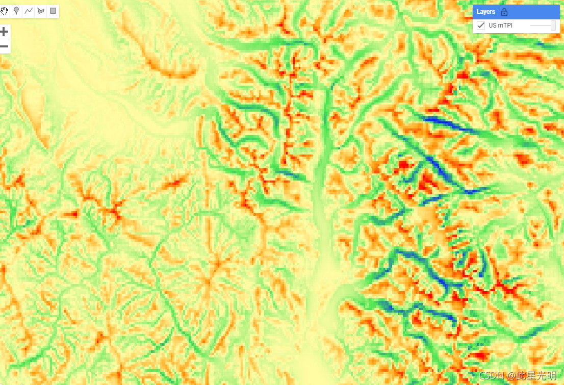
The mTPI distinguishes ridge from valley forms. It is calculated using elevation data for each location subtracted by the mean elevation within a neighborhood. mTPI uses moving windows of radius (km): 115.8, 89.9, 35.5, 13.1, 5.6, 2.8, and 1.2. It is based on the USGS's 10m NED DEM (available in EE as USGS/NED).
The Conservation Science Partners (CSP) Ecologically Relevant Geomorphology (ERGo) Datasets, Landforms and Physiography contain detailed, multi-scale data on landforms and physiographic (aka land facet) patterns. Although there are many potential uses of these data, the original purpose for these data was to develop an ecologically relevant classification and map of landforms and physiographic classes that are suitable for climate adaptation planning. Because there is large uncertainty associated with future climate conditions and even more uncertainty around ecological responses, providing information about what is unlikely to change offers a strong foundation for managers to build robust climate adaptation plans. The quantification of these features of the landscape is sensitive to the resolution, so we provide the highest resolution possible given the extent and characteristics of a given index.
mTPI区分了山脊和山谷的形式。mTPI使用半径为115.8、89.9、35.5、13.1、5.6、2.8和1.2的移动窗口来计算,它是用每个地点的高程数据减去邻域内的平均高程。它基于美国地质调查局的10米NED DEM(在EE中可作为USGS/NED)。
保护科学伙伴(CSP)生态相关地貌(ERGo)数据集、地貌和地形学包含详细的、多尺度的地貌和地形学(又称土地面)模式数据。尽管这些数据有许多潜在的用途,但这些数据的最初目的是开发适合气候适应规划的生态相关的地貌和自然地理类别的分类和地图。因为未来的气候条件有很大的不确定性,围绕生态反应的不确定性甚至更大,提供有关不太可能改变的信息为管理者建立强大的气候适应计划提供了一个坚实的基础。景观的这些特征的量化对分辨率很敏感,所以我们在给定指数的范围和特征的情况下,提供尽可能高的分辨率。
Dataset Availability
2006-01-24T00:00:00 - 2011-05-13T00:00:00
Dataset Provider
Collection Snippet
ee.Image("CSP/ERGo/1_0/US/mTPI")
Resolution
270 meters
Bands Table
| Name | Description | Min | Max | Units |
| elevation | NED-derived mTPI ranging from negative (valleys) to positive (ridges) values | -378 | 493 | Meters |
CODE:
var dataset = ee.Image('CSP/ERGo/1_0/US/mTPI');
var usMtpi = dataset.select('elevation');
var usMtpiVis = {
  min: -200.0,
  max: 200.0,
  palette: ['0b1eff', '4be450', 'fffca4', 'ffa011', 'ff0000'],
};
Map.setCenter(-105.8636, 40.3439, 11);
Map.addLayer(usMtpi, usMtpiVis, 'US mTPI');