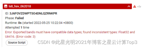
这里我们在进行影像展示的时候会出现下面的错误,主要的原因是我们虽然进行了波段运算,但是依旧无法加载,主要原因是我们没有将计算过后的波段信息进行添加到我们的一个多波段影像,这里我们首先来看看代码出现的错误提示。当然这里只是给出了主要的问题,其实在进行波段运算的时候
错误:
mNDWI (Saison Sèche 2023): Layer error: Image.select: Pattern 'mndwiDry' did not match any bands.
EVI (Saison Sèche 2023): Layer error: Image.select: Pattern 'eviDry' did not match any bands.
AWEIshadow (Saison Sèche 2023): Layer error: Image.select: Pattern 'aweiShadowDry' did not match any bands.
NDVI (Saison Sèche 2023): Layer error: Image.select: Pattern 'ndviDry' did not match any bands.
mNDWI (Saison des pluies 2023): Layer error: Image.select: Pattern 'mndwiWet' did not match any bands.
EVI (Saison des pluies 2023): Layer error: Image.select: Pattern 'eviWet' did not match any bands.
AWEIshadow (Saison des pluies 2023): Layer error: Image.select: Pattern 'aweiShadowWet' did not match any bands.
NDVI (Saison des pluies 2023): Layer error: Image.select: Pattern 'ndviWet' did not match any bands.
原始代码:
// Choisissez une région d'intérêt (ROI)
var geometry =
    /* color: #d63000 */
    /* displayProperties: [
      {
        "type": "rectangle"
      }
    ] */
    ee.Geometry.Polygon(
        [[[-6.577358626376397, 9.542052661722291],
          [-6.577358626376397, 9.181623347675282],
          [-5.855007552157647, 9.181623347675282],
          [-5.855007552157647, 9.542052661722291]]], null, false);
// Filtrer les images pour la saison sèche (de janvier à mars)
// Année 2023
var year = 2023;
var landsat8Collection = ee.ImageCollection("LANDSAT/LC08/C02/T1_TOA")
//Ajouter une couche de couleur à la zone pour bien visualiser//
Map.addLayer(geometry, {color: '001155'}, 'Zone d\'étude'); // Code de couleur bleuât
Map.centerObject(geometry, 9);
//Mettre en place la fonction de masque des nuages pour une image de qualité sans nuage//
function maskL8srClouds(image) {
  //Les bits 3 et 5 correspondent respectivement à l'ombre et au nuage
  var cloudShadowBitMask = (1 << 3);
  var cloudsBitMask = (1 << 5);
  // selectionner bande pixel QA (Assurance Qualité).
  var qa = image.select('QA_PIXEL');
  // Les deux opérations doivent être réglées à zéro,
  // indiquant des conditions claire
  var mask = qa.bitwiseAnd(cloudShadowBitMask).eq(0)
                .and(qa.bitwiseAnd(cloudsBitMask).eq(0));
  return image.updateMask(mask);
}
// Construire une image composite pour la saison sèche//
var imageDry = landsat8Collection.filterBounds(geometry)
                .filterDate('2023-01-01', '2023-03-31')
                .filterMetadata('CLOUD_COVER','less_than', 10)
                .map(maskL8srClouds)
                .median()
                .clip(geometry);
//Map.addLayer(imageDry)
// Imprimer les noms de bandes pour une image pendant la saison sèche
print("Bands in imageDry:", imageDry.bandNames());
// Ajouter un dictionnaire de visualisation de l'image saison sèche. Les valeurs min, max//
//et l'étirement peuvent être modifiées pour chacune des trois bandes.//
var L8DryVis = {bands:['B4', 'B3', &#


